ASIGN SERVER

SITUATIONAL AWARENESS FOR DECISION MAKERS

The ASIGN Online Server is developed to give the decision makers the best possible visual situational awareness.  The server is also used to manage the users and to integrate data into other systems, like mapping / GIS portals. 

 ASIGN field communication tools send initial data representing full observations to the ASIGN Server, from where users can pull the details needed to have the desired effect on the operations. The initial data is typically 0.1-1% or less of the full-resolution images. Incoming geo-tagged and time stamped data can be shown in Album view and/or on a map.  From the Server, users can easily assess incoming data, pull more details from observations if needed, and filter the data. The Server is also where users’ missions and assessment forms can be created and managed, as well as information shared onwards to non-ASIGN users.

All ASIGN software has been made to work smoothly even in critical situations with low bandwidth.

The ASIGN Server is where the data is received. It is accessed via a Web User Interface or an API

EFFECTIVE DATA MANAGEMENT FOR RAPID DECISION-MAKING

 ASIGN allows for the filtering of incoming data by several parameters, such as location, time, mission, user, type of observation, category and critical status. Computer Vision can help recognize features the system is trained for such as faces, cars and license plates. 

ASIGN can overall support the fast development of situational awareness, mission management, and shorten response time.

Data Integration

The ASIGN server is connected securely via two possible communication modes:

  • A proprietary, highly robust and efficient protocol called GR4-COMS, an acronym for “Globally Rapid Reliable Resilient and Robust Communications Optimized for Mobile and Satellite”.
  • An open API accessible by Web or other applications.

ASIGN Servers have a Web User Interface able to run in all common browsers. Via the API, it is possible to develop other Web interfaces and use ASIGN as a very effective communications engine (and more).

Data can also be accessed via an API, e.g. for remote data analysis or integration with other systems. The API can also be used to inject commands into the ASIGN system. ASIGN data can be shared from the ASIGN server with a remote GIS mapping platform.

Secure Hosting

AnsuR hosts several ASIGN servers in various regions. We also host one for UN at CERN in Geneva, where the World Wide Web was invented. It is also possible for customers to own their own servers installed with ASIGN to have total ownership of the data.

The server holds the relevant data that is sent to the server, while all other information is still stored at the sender side. Data sent to the ASIGN Server is encrypted end-to-end. Local data is encrypted in the smartphones.

ASIGN Server Pricing

  • On AnsuR hosted servers, ASIGN is offered as a subscription-based service. It can be purchased via our web shop or via other payment methods.
  • For customer hosted servers, options exist both for subscriptions and traditional one-time fees. Please contact us to discuss the available options.

ASIGN SERVER FEATURES

Assessment Forms

Create and share customized assessment forms with field users. Download and assess collected data.

Tracking

Monitor location of first responders.

Users & Missions

Create and administer users, manage missions, message individuals or teams, share information with internal or external parties.

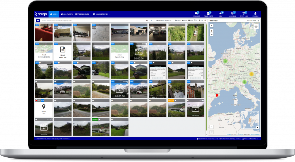
Information management

Rapidly detect, manage and filter observations. Turn data into information.

Geo-Alerts

Set Geo-Alerts to notify field users of dangerous or safe zones.