UAV-ASIGN

REAL-TIME LINE-OF-SIGHT UAV IMAGES

UAV-ASIGN connects a pilot flying a UAV to remote viewers, bringing real-time high definition UAV photo and video to decision makers, also when flying in locations with potentially limited bandwidth. UAV-ASIGN can even share high precision content also via mobile satellite communications.

UAV-ASIGN allows both a faster tactical response and operational interaction with remote experts.  

Target use cases include Search & Rescue missions, emergency management, disaster assessment, security and reconnaissance. Use cases also include remote inspection and infrastructure monitoring.

It specifically supports DJI drones, but is applicable to other drones using smartphones or tablets as part of the control station.

  • <?php echo esc_html($alt); ?>
Device Slider

ASIGN for Optimal Communication

Real-time interaction with remote Experts, Decision Makers or Clients

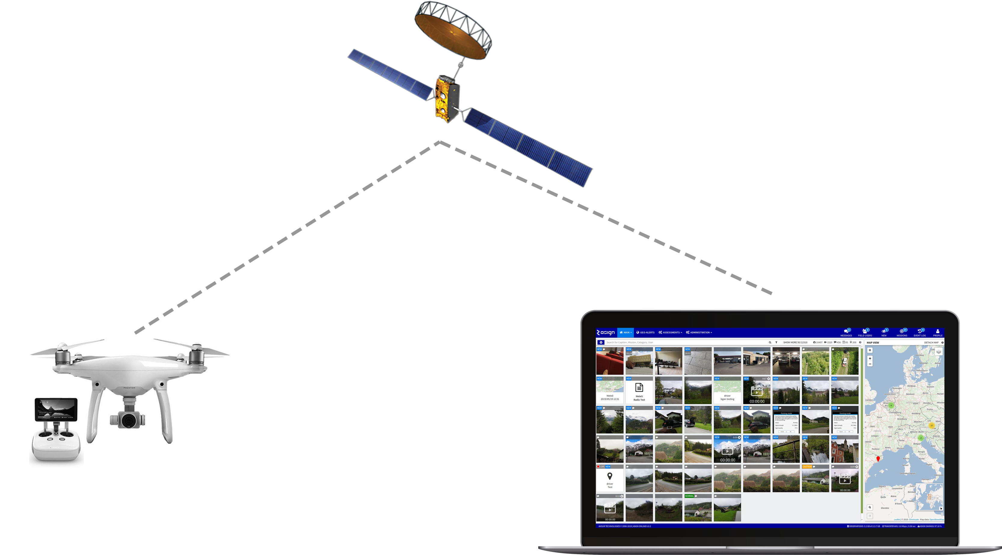
Using up to 99% less bandwidth, UAV-ASIGN images can be captured and automatically sent to the ASIGN Server.  Via a browser, seconds after capture, these images can be assessed by experts and decision makers directly. 

Remote experts can also help the UAV pilot fly over the most relevant area and capture the most relevant content. 

If needed, a client could approve images in real-time. 

Multiple viewers in different locations can help analyze the high precision image content, freeing up the UAV pilot from analyzing content and relevance. 

In contrast to live video, photos typically have 10X or more resolution, so by sending a high-precision photo, UAV-ASIGN enables faster and more precise analysis. Better precision improves detection probability and a fast communication speed ensures content is available within required response time.

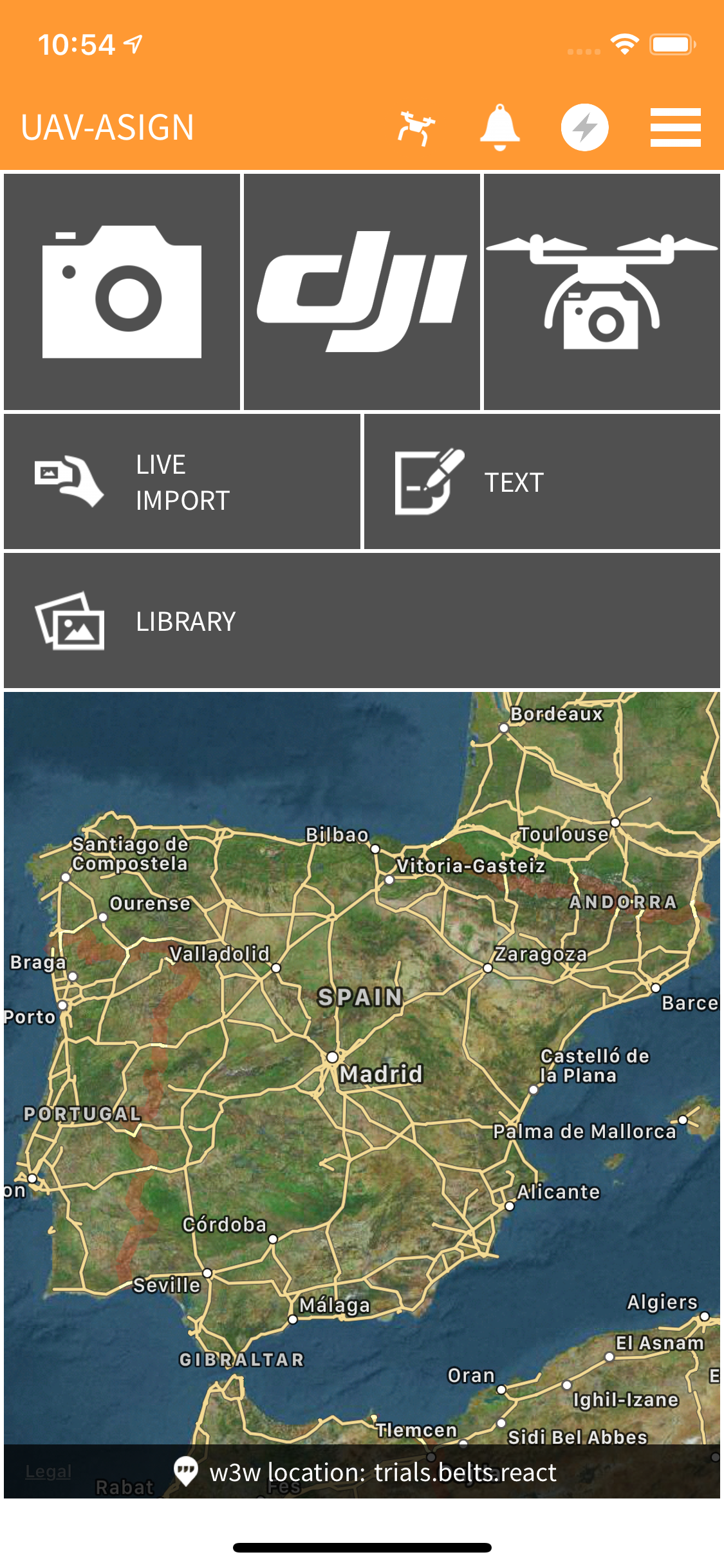
UAV-ASIGN is optimized for DJI drones and works with any drone that uses a smartphone as part of the drone remote control. It can run in control stations running Android or iOS. 

UAV-ASIGN FEATURES

Photo & Video

Capture and send photos and videos during flight

DJI Support

Special DJI support feature without the need to use the DJI App

Geo-Timer

Select areas over which the drone should automatically take and send photos at chosen time intervals

Library

Pilot can push regions of interest, comment and share geo-photos, video and details

Stay Informed

JOIN OUR MAILING LIST

What Are You Waiting for?

PURCHASE UAV ASIGN

PARTNERS